Flat Earth map: the azimuthal equidistant projection
Maps · Updated
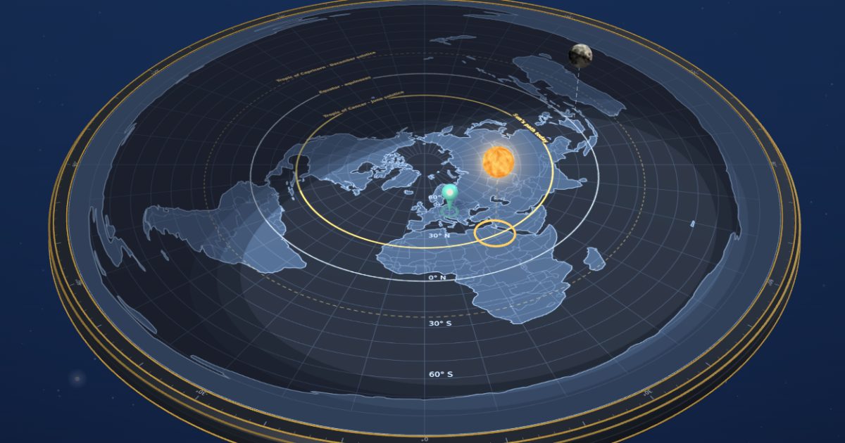
The flat Earth map is a north-polar azimuthal equidistant projection: the North Pole in the centre, every distance from the pole true, and Antarctica stretched into a ring around the rim. It is the layout of Alexander Gleason’s New Standard Map of the World (1892). FlatAtlas draws it 40,000 km across and shows it in 3D.
What is an azimuthal equidistant projection?
It is a way to draw the round Earth on a flat surface so that distances and directions from one central point are correct. On the flat Earth map that point is the North Pole: each circle of latitude is drawn at its true distance from the pole, 10,000 km to the Equator and 20,000 km to the South Pole, which becomes the outer rim.
Gleason’s New Standard Map of the World (1892)
Alexander Gleason published this projection in 1892 as a “longitude and time calculator”, with a 24-hour ring around the edge and an arm to read the time anywhere. He patented a related time chart in 1893. The map was offered as the Earth “as it is”, and flat Earth maps shared today use the same layout. FlatAtlas has the same projection and scale, with optional layers for the Sun’s daily path and Gleason’s 24-hour ring.
How distances change on the flat Earth map
Distances from the North Pole are true, but distances along a circle of latitude grow towards the south. The table compares the length of one degree of longitude on the flat Earth map with the same degree on the globe.
| Latitude | 1° of longitude on the flat map | on the globe | Flat map / globe |
|---|---|---|---|
| 60° N | 58 km | 56 km | 1.0× |
| 45° N | 87 km | 79 km | 1.1× |
| 30° N | 116 km | 96 km | 1.2× |
| 0° (Equator) | 175 km | 111 km | 1.6× |
| 30° S | 233 km | 96 km | 2.4× |
| 45° S | 262 km | 79 km | 3.3× |
| 60° S | 291 km | 56 km | 5.2× |
North of the Equator the two stay close. In the south they drift apart: at 45° S the flat map is more than three times longer. You can compare this with distances and flight times you know.
Where is Antarctica on the flat Earth map?
Antarctica is not a continent in the middle of the southern ocean but a ring around the whole edge of the map, about 125,000 km long. The Flat Earth Society FAQ describes it as an ice wall that holds the oceans back.
Frequently asked questions
What projection is the flat Earth map?
A north-polar azimuthal equidistant projection, centred on the North Pole, with distances from the pole drawn true.
Who made the first flat Earth map?
The best-known one is Alexander Gleason’s New Standard Map of the World, published in 1892 and held today by the Leventhal Map & Education Center in Boston.
How big is the flat Earth map?
Drawn with true distances from the North Pole, it is about 40,000 km across, the distance from the North Pole to the South Pole and back on the globe.